
Skycap

Your flight, explained.

Other trackers show where the plane is. Skycap says what that means for you: when to leave, how the ride should feel, why it is late, and when you will be at the curb.

Get Skycap on TestFlight

In beta for iPhone, iPad and Mac.

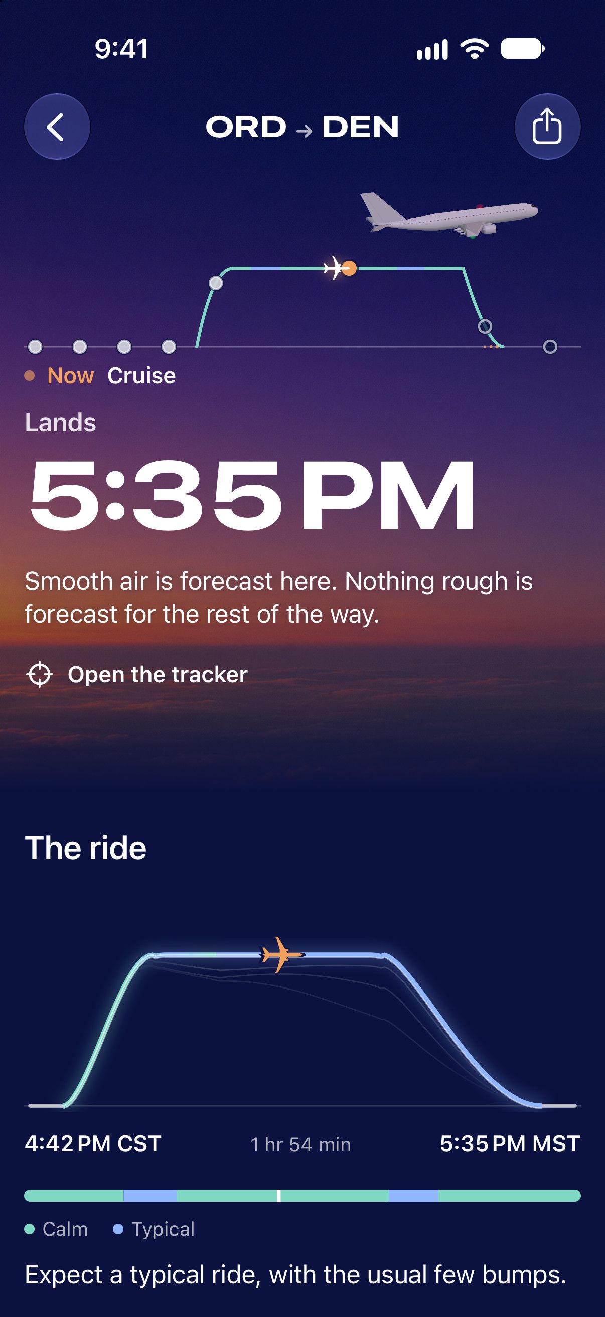
The Flight page at cruise from Chicago to Denver at dusk, the plane drawn over the sky: Lands 5:35 PM. Smooth air is forecast here. Nothing rough is forecast for the rest of the way. Below, the ride as a profile, calm then typical.

Track your flight from the night before to the curb.

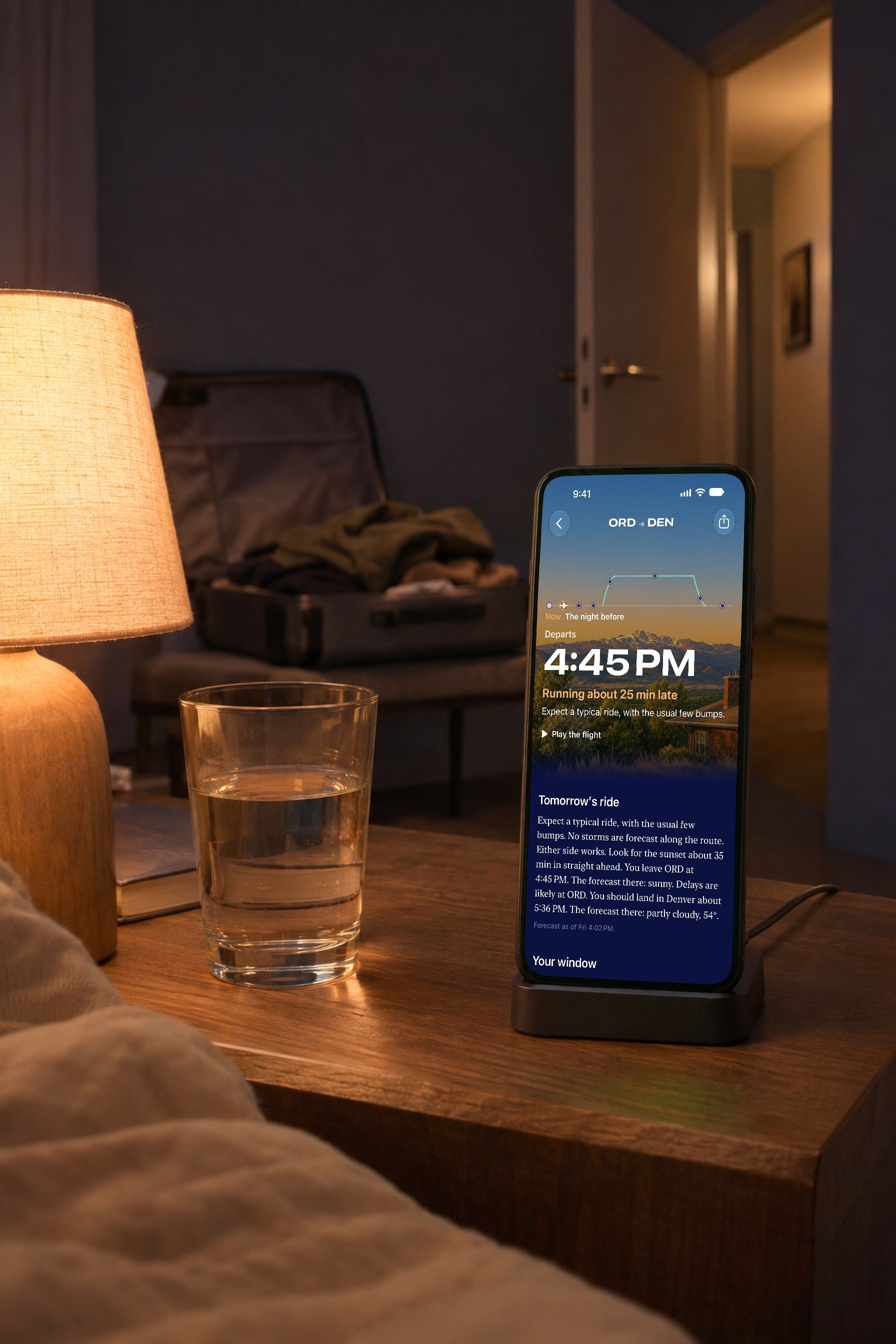
A phone on a charging stand on a nightstand, lamp lit, a half-packed carry-on on a bench across the bedroom. On its screen, the Flight page the night before: Departs 4:45 PM, running about 25 min late, and tomorrow’s ride in a paragraph.

The night before

Know how bumpy it will be.

A plain-language ride forecast the evening before: bumps, storms, which side gets the sunset, and the weather at both ends.
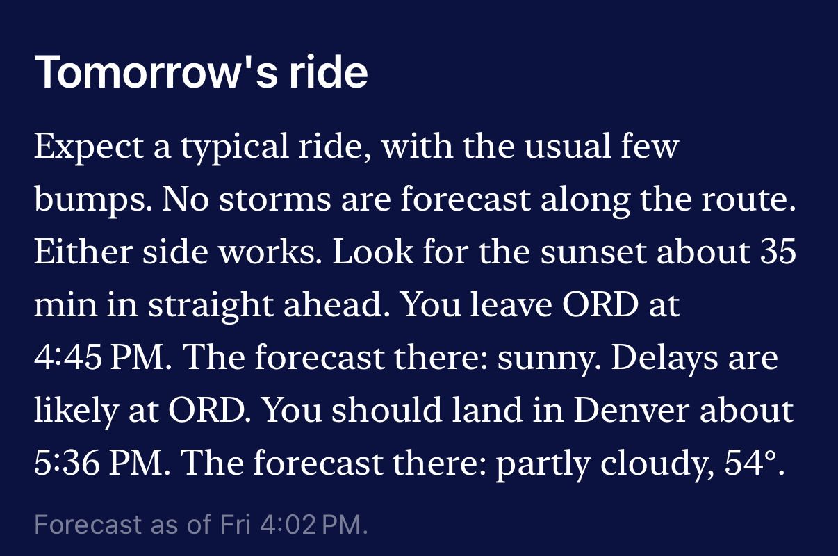
Tomorrow’s ride: Expect a typical ride, with the usual few bumps. No storms are forecast along the route. Either side works. Look for the sunset about 35 min in straight ahead. You leave ORD at 4:45 PM. The forecast there: sunny. Delays are likely at ORD. You should land in Denver about 5:36 PM. The forecast there: partly cloudy, 54°.
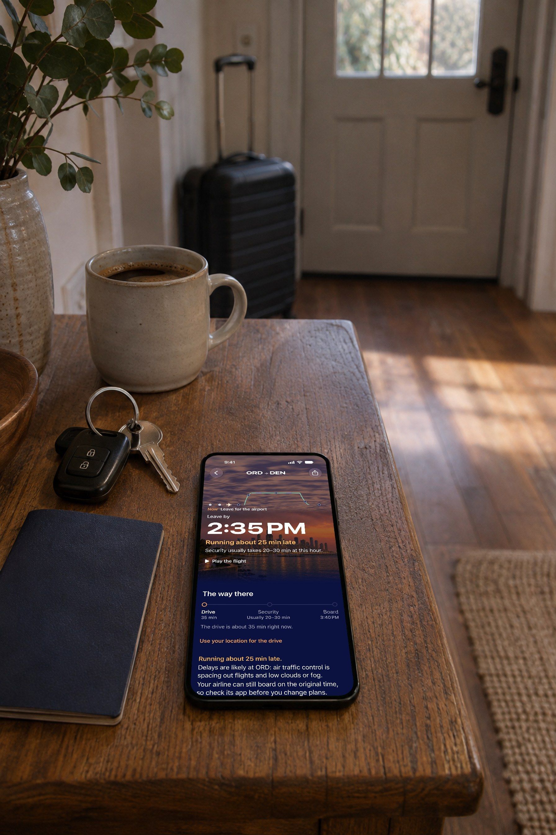
A phone on the console table by a front door beside car keys, a passport and a coffee, a carry-on standing ready at the door. On its screen, the Flight page: Leave by 2:35 PM, and the way there.

Time to go

Know exactly when to leave.

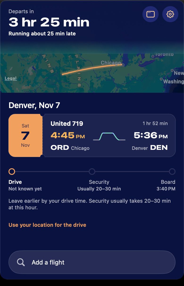
Your drive, security and boarding added into one time, updated when your flight slips.

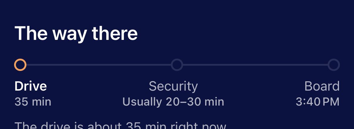
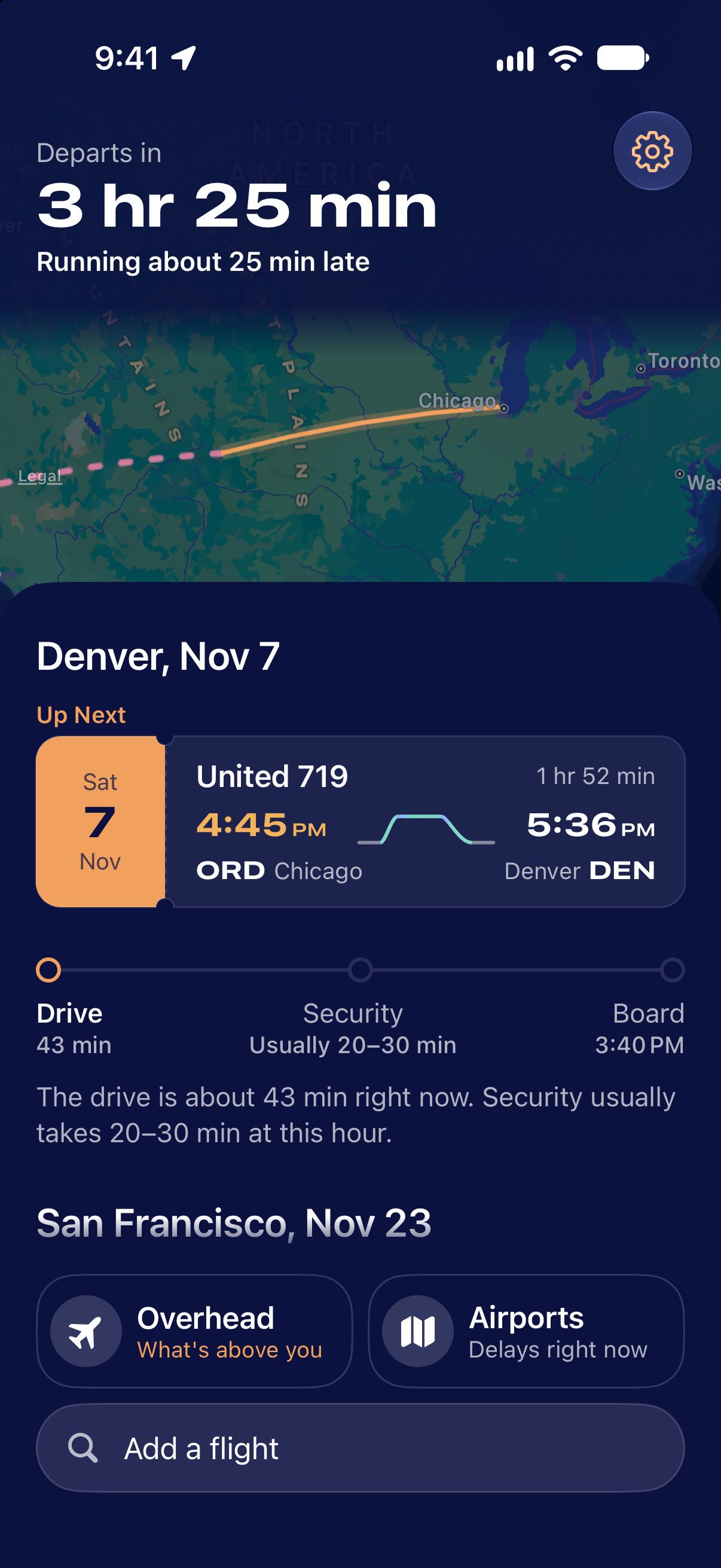
Now, leave for the airport. Leave by 2:35 PM. Running about 25 min late. Security usually takes 20–30 min at this hour. The way there: drive 35 min, security usually 20–30 min, board 3:40 PM. The drive is about 35 min right now.
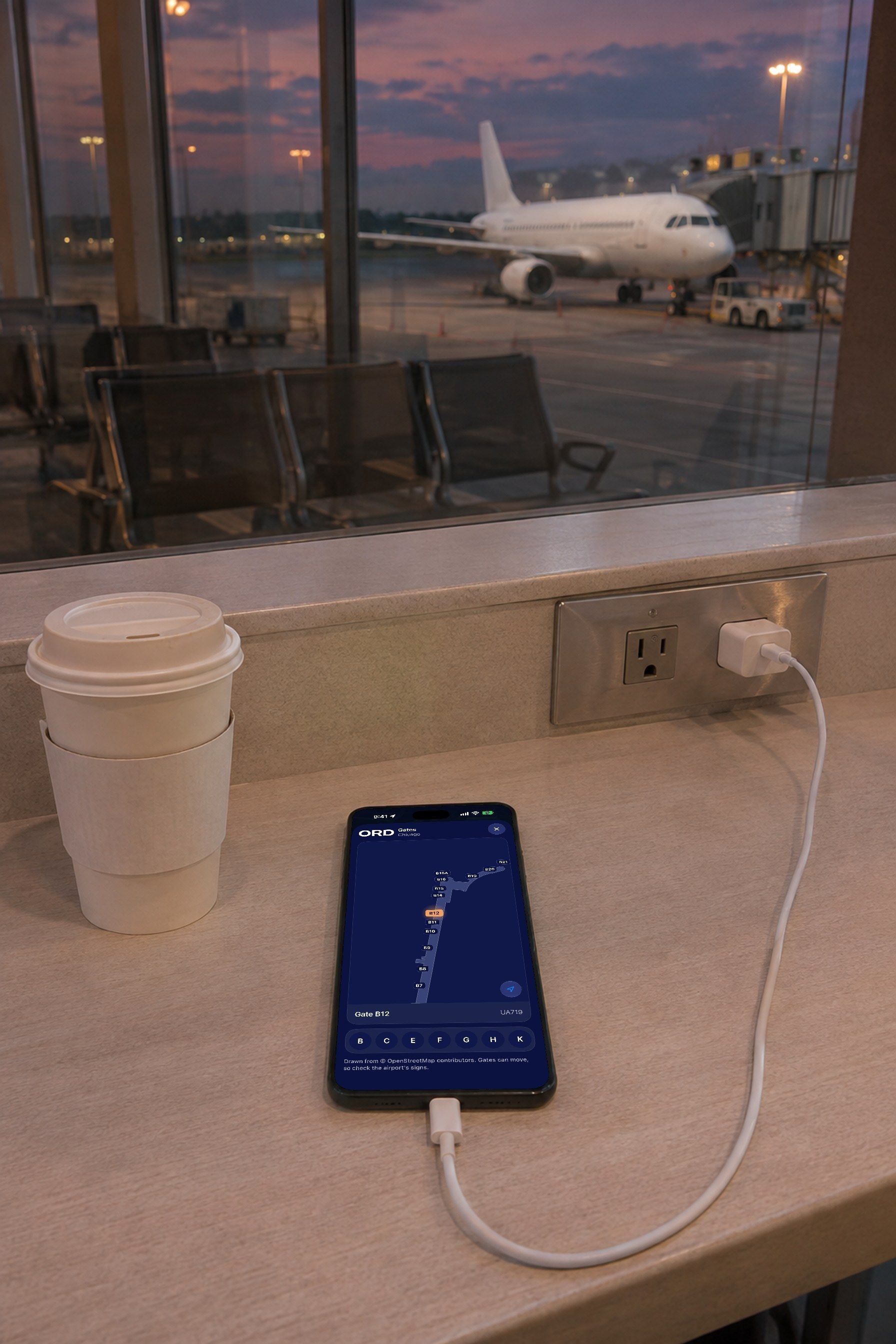
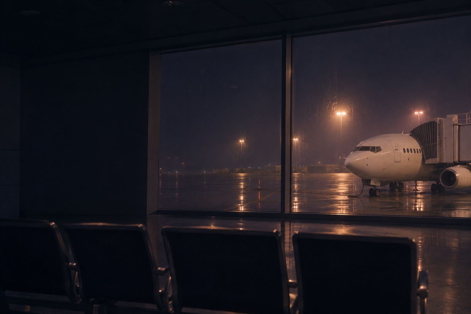
A phone charging on the counter along a gate’s window wall beside a coffee, a plain white airliner at the jet bridge outside at dusk. On its screen, the gate map at O’Hare: Concourse B from above, gate B12 lit, UA719.

At the airport

Find your gate. See why you’re late.

A map of the terminal with your gate lit, and the reason for a delay in one sentence.
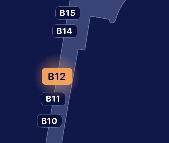
The gate map close up: gates B10, B11, B14 and B15 along the concourse, and B12 lit in apricot. Boards in about 1 hr. Running about 25 min late. Delays are likely at ORD: air traffic control is spacing out flights and low clouds or fog.
A locked phone on a cafe counter beside an espresso and half a croissant, the flight’s Live Activity on its Lock Screen.

While you wait

Your flight on the Lock Screen.

Where the plane is, when it lands and how the ride should feel, live, without opening the app.
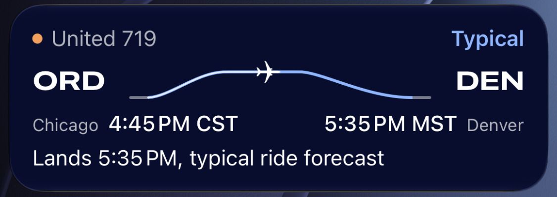
The Live Activity: United 719, typical. ORD, Chicago, 4:45 PM CST to DEN, Denver, 5:35 PM MST. Lands 5:35 PM, typical ride forecast.
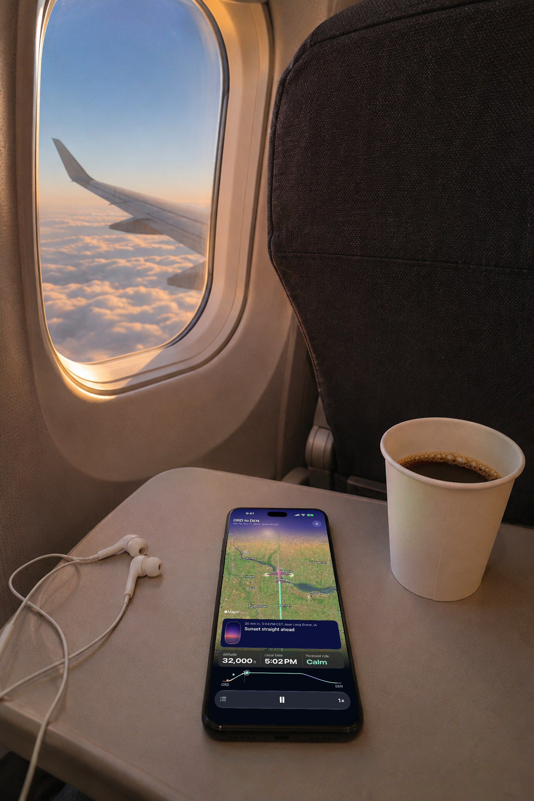
A phone on a window seat’s tray table beside a coffee and earphones, the wing over a sea of cloud in low sun outside. On its screen, the flight playing: the plane over the map at 32,000 ft, the ride marked calm.

In the air

Follow the flight from your seat.

A moving map of where you are, what is out the window, and how smooth the air ahead is.
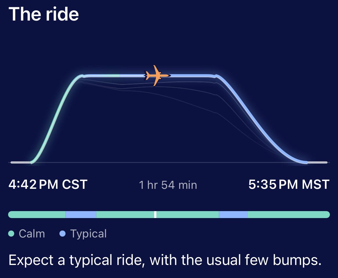
The ride: the flight’s profile from 4:42 PM CST to 5:35 PM MST, 1 hr 54 min, the plane at cruise, coloured calm and typical. Expect a typical ride, with the usual few bumps.

Other trackers give you a status. Skycap tells you what to do.

Pick a moment to compare what you usually get with what Skycap says.

The night beforeSkycap says

Expect a typical ride, with the usual few bumps.

The ride forecast for your route and your hour, in one sentence you could read aloud. Typical means like most flights.

Now, the night before. Departs 4:45 PM. Running about 25 min late. Expect a typical ride, with the usual few bumps.

LeavingSkycap says

Leave by 2:35 PM. Security usually takes 20–30 min at this hour.

The drive, security at that hour and boarding, added into one time. If the flight slips, the time moves with it.

The way there: drive 35 min, security usually 20–30 min, board 3:40 PM.

At the airportSkycap says

Delays are likely at ORD: air traffic control is spacing out flights and low clouds or fog.

The reason comes with the delay, so you can tell whether it is likely to grow. The airline can still board on the original time, so check its app before you change plans.
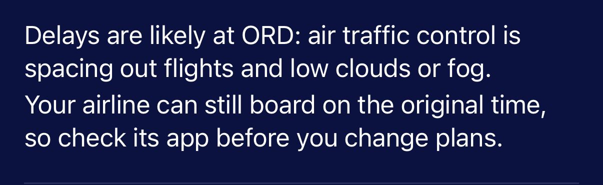
Delays are likely at ORD: air traffic control is spacing out flights and low clouds or fog. Your airline can still board on the original time, so check its app before you change plans.

In the airSkycap says

Lands 5:35 PM. Smooth air is forecast here. Nothing rough is forecast for the rest of the way.

One landing time, and what the ride will be like from where you are now.
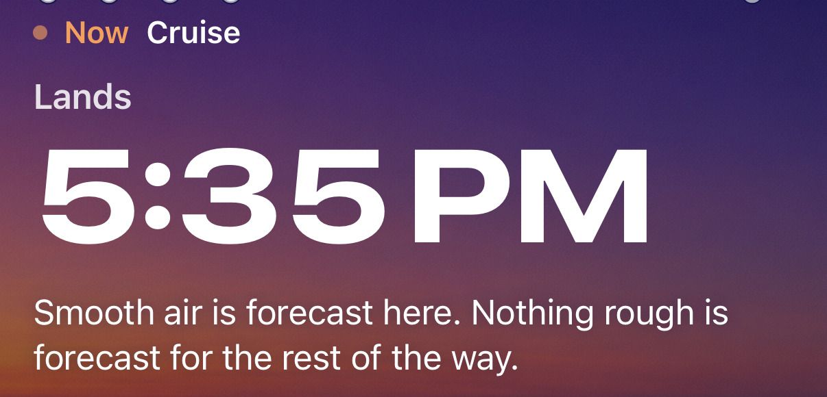
Now, cruise. Lands 5:35 PM. Smooth air is forecast here. Nothing rough is forecast for the rest of the way.

LandedSkycap says

At the curb about 5:55 to 6:35 PM. A checked bag adds about 5 min.

Landed is not outside. The taxi to the gate, getting off from your row and the walk out are each counted, so the car is booked for the right few minutes.
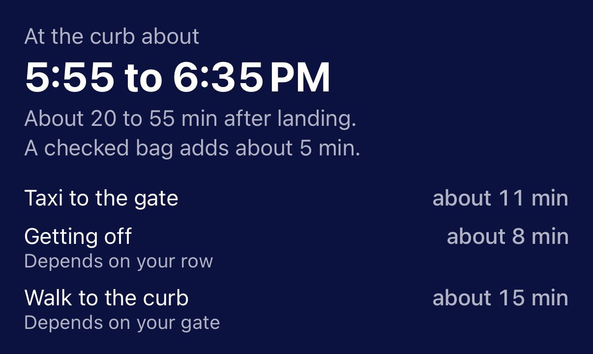
At the curb about 5:55 to 6:35 PM. About 20 to 55 min after landing. A checked bag adds about 5 min. Taxi to the gate about 11 min, getting off about 8 min, walk to the curb about 15 min.

ConnectingSkycap says

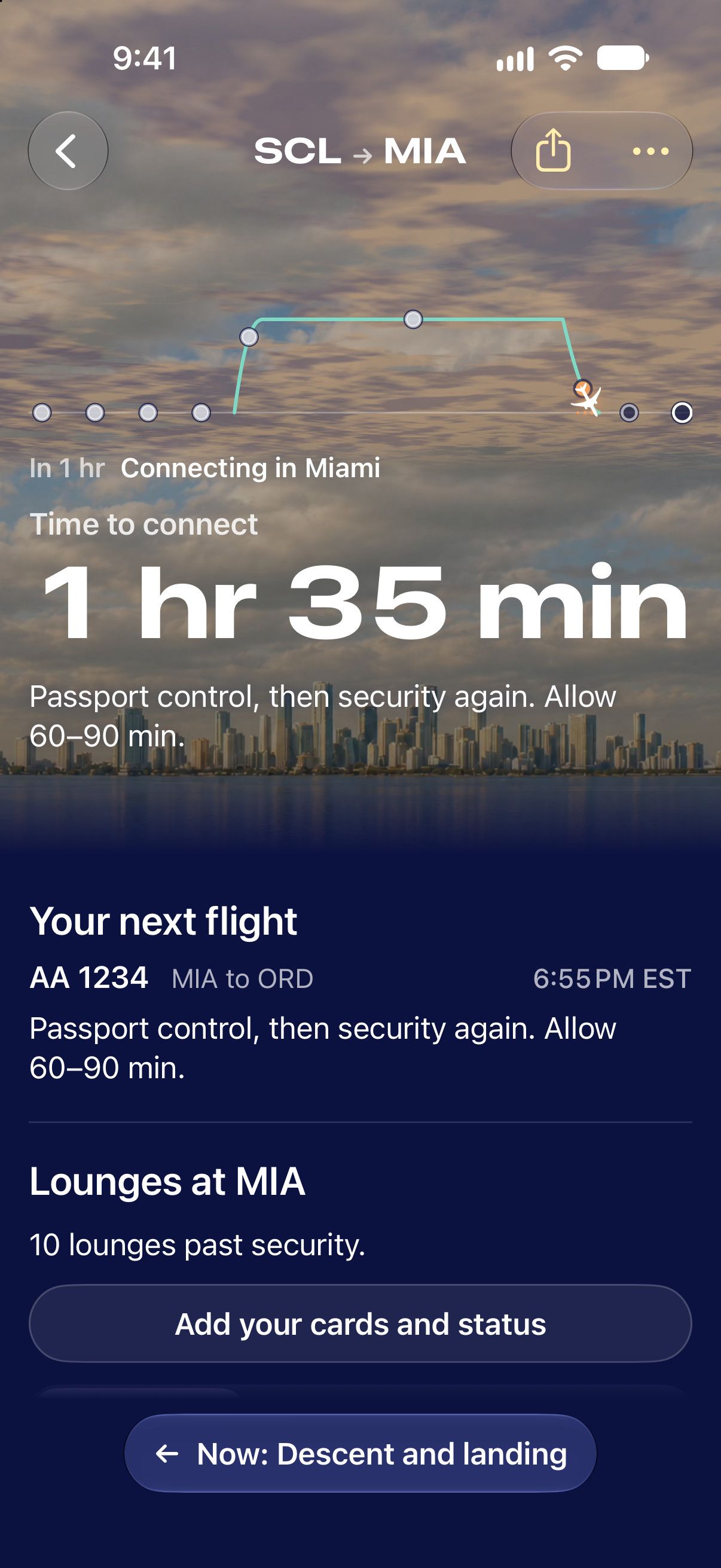
Time to connect: 1 hr 35 min. Passport control, then security again. Allow 60–90 min.

The minutes you have, and what stands between you and the next gate.
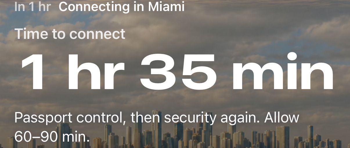
In 1 hr, connecting in Miami. Time to connect: 1 hr 35 min. Passport control, then security again. Allow 60–90 min.

A turbulence forecast and window views for your route.

See where the bumps are, how long they last, and which side to sit on for the views.

Skycap Sacramento to Denver

About 10 min of bumpier air is forecast along the way. Sit on the left for Lake Tahoe and the Rockies’ Front Range, if the route holds.
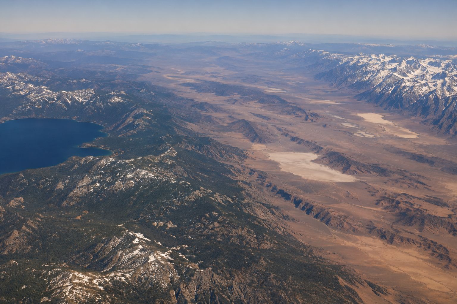
The land under the flight, from the air: a deep blue mountain lake on the left, pale desert basins across the middle, and a wall of snow-capped mountains dropping to open plains on the right.

SMF SacramentoDEN Lands 3:45 PM

  1. Lake Tahoe Out the left window, on the climb.
  2. Bumpy stretch About 10 min, then it stops.
  3. The Rockies’ Front Range Out the left window, on the way down.
Typical Bumpier Calmer

Add your flight and Skycap does the rest.

Identify any plane flying overhead.

Point your phone at the sky. Every plane is named, with its type, its route, how high it is and how close it will pass.
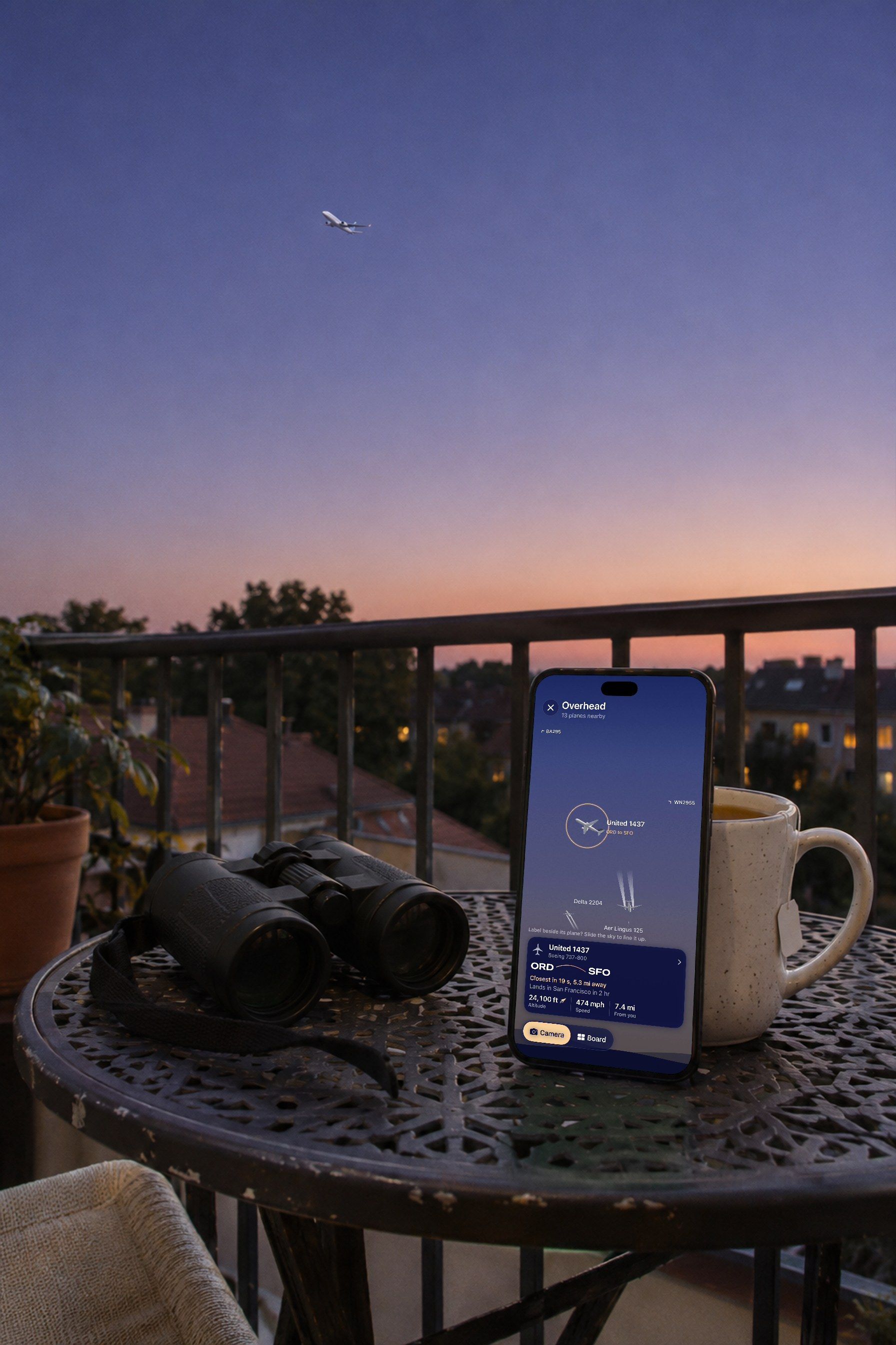
A phone leaning against a mug on a balcony table beside binoculars, a small airliner climbing away in the dusk sky beyond the rail. On its screen, Overhead: 13 planes nearby, United 1437 ringed in the sky, ORD to SFO, closest in 19 s.
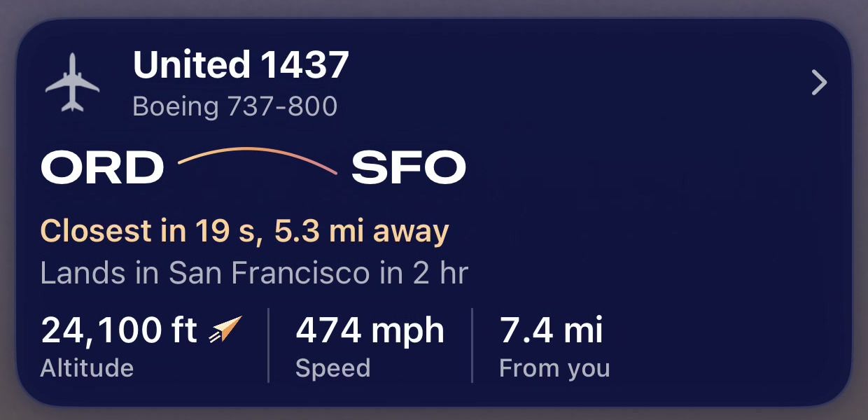
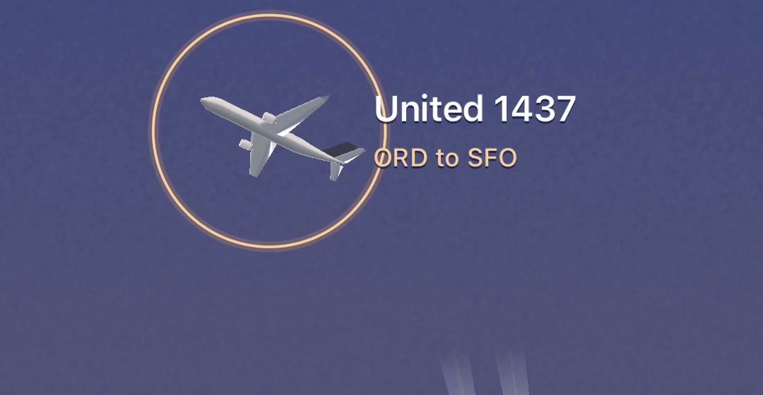
Overhead close up: a plane drawn in the sky inside a ring, labelled United 1437, ORD to SFO. United 1437, Boeing 737-800, ORD to SFO. Closest in 19 s, 5.3 mi away. Lands in San Francisco in 2 hr. 24,100 ft altitude, 474 mph, 7.4 mi from you.

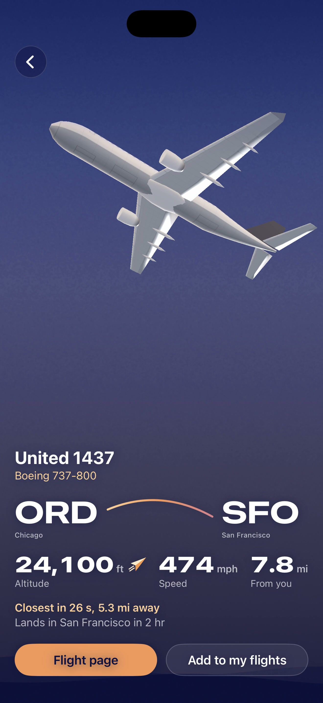
Tap one and it comes up close. Or read them off a board: to your right, high up.
How to tell what plane that is

A plane tapped in Overhead, drawn up close in the dusk sky: United 1437, Boeing 737-800, ORD to SFO. 24,100 ft, 474 mph, 7.8 mi from you. Closest in 26 s. Buttons for its Flight page and to add it to your flights.
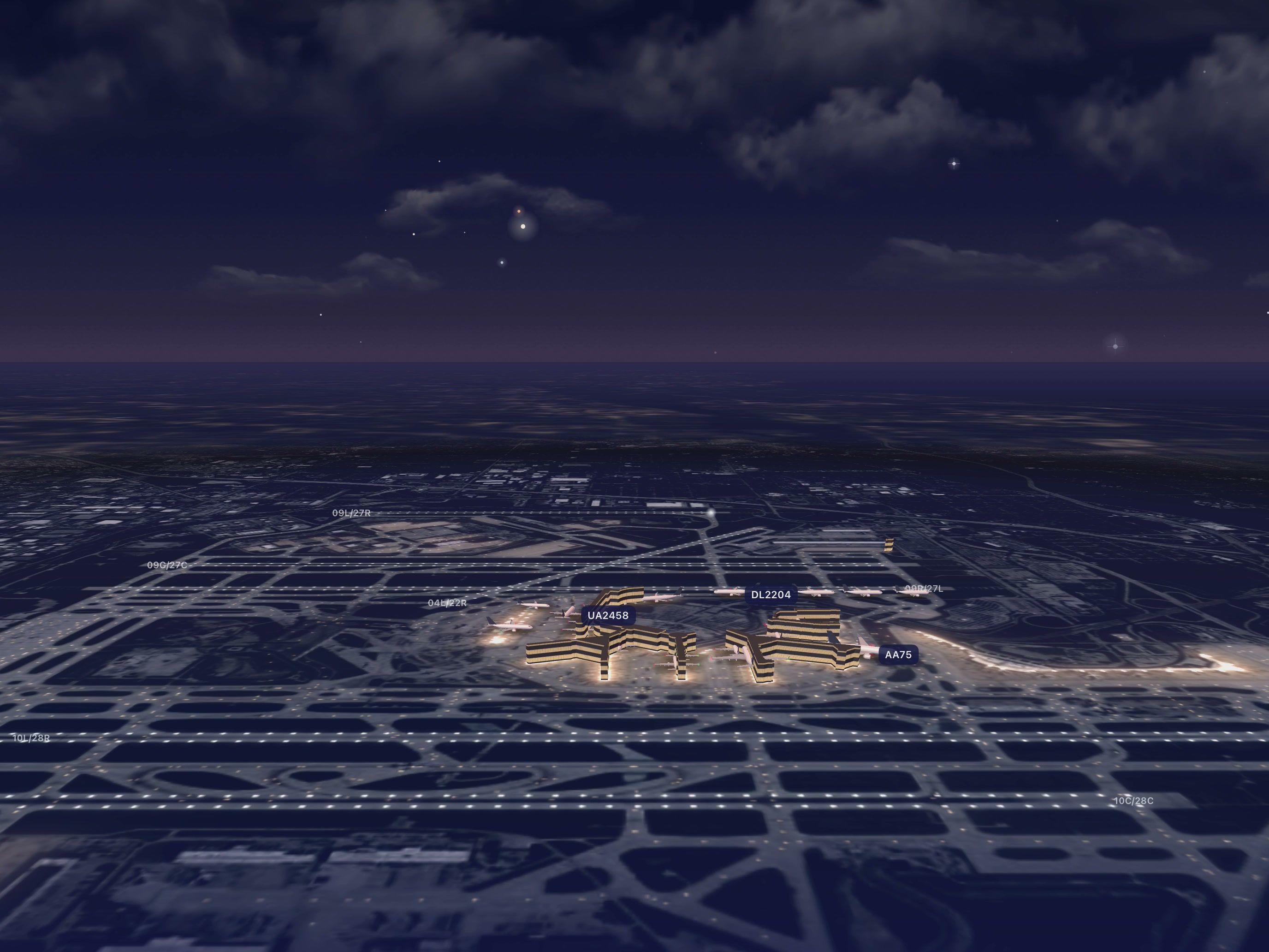
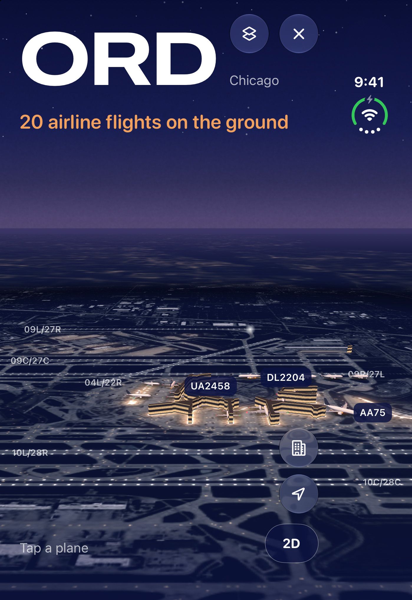
On the field in the app: O’Hare after dark from above in 3D, the terminals lit, runways and taxiways marked, and planes at their gates and taxiing, three of them labelled UA2458, DL2204 and AA75.

See any airport live, in 3D.

Terminals, runways and taxiways with the real planes on them: at their gates, taxiing, in line for takeoff. Tap any plane to see where it is going.

Live delays at every airport.

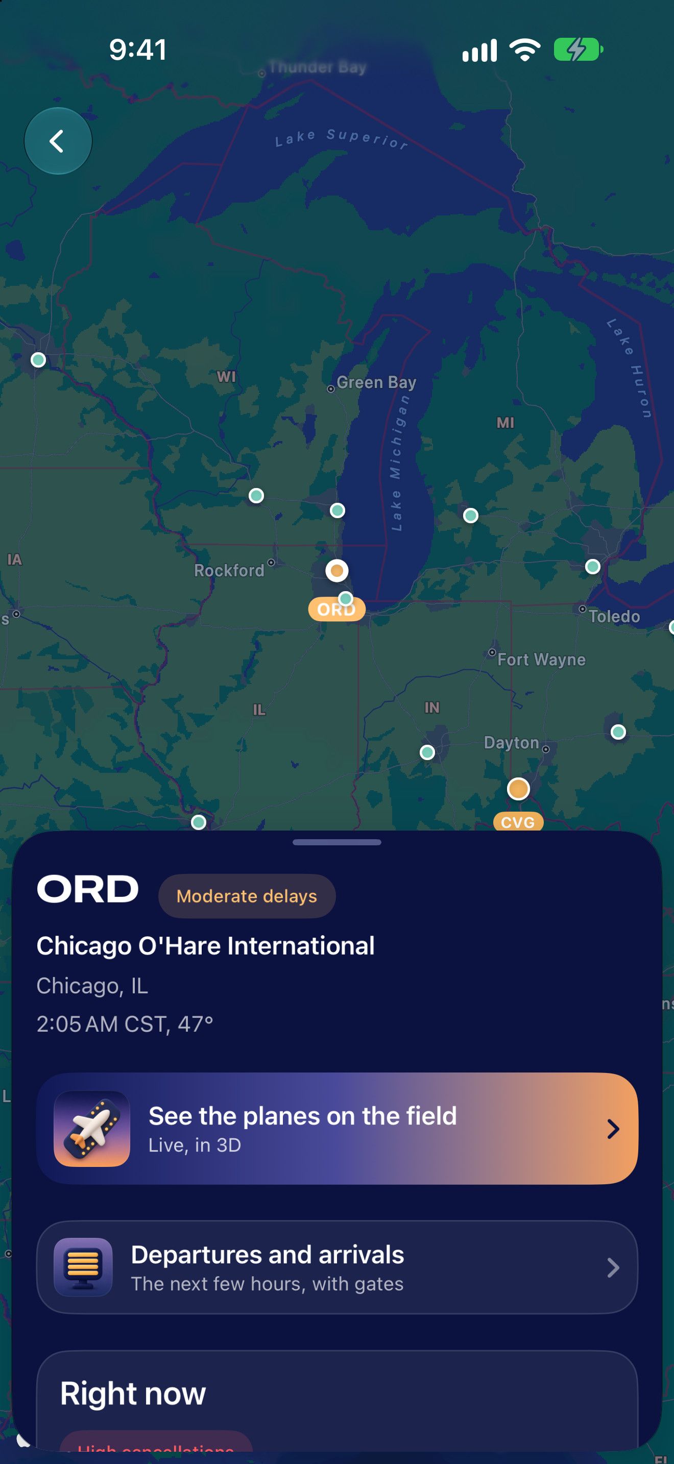
A map of which airports are running late, and a page for each with its delays, weather, departures and arrivals.
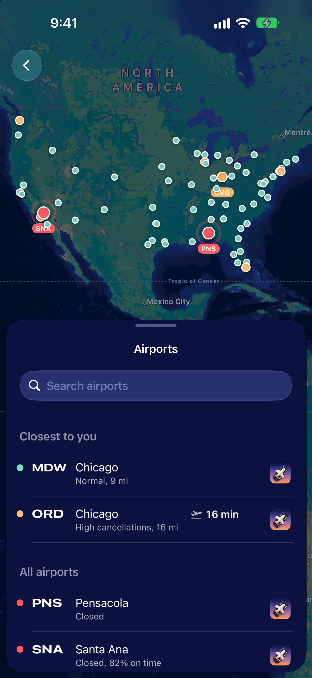
Airports in the app: a map of North America with a dot for each airport, coloured by its delays, Pensacola and Santa Ana in red. Below, the list: closest to you, Midway normal, O’Hare 16 min; all airports.
O’Hare’s page in the app: ORD, moderate delays, Chicago O’Hare International, 2:05 AM CST, 47°. See the planes on the field, live, in 3D. Departures and arrivals, the next few hours, with gates.
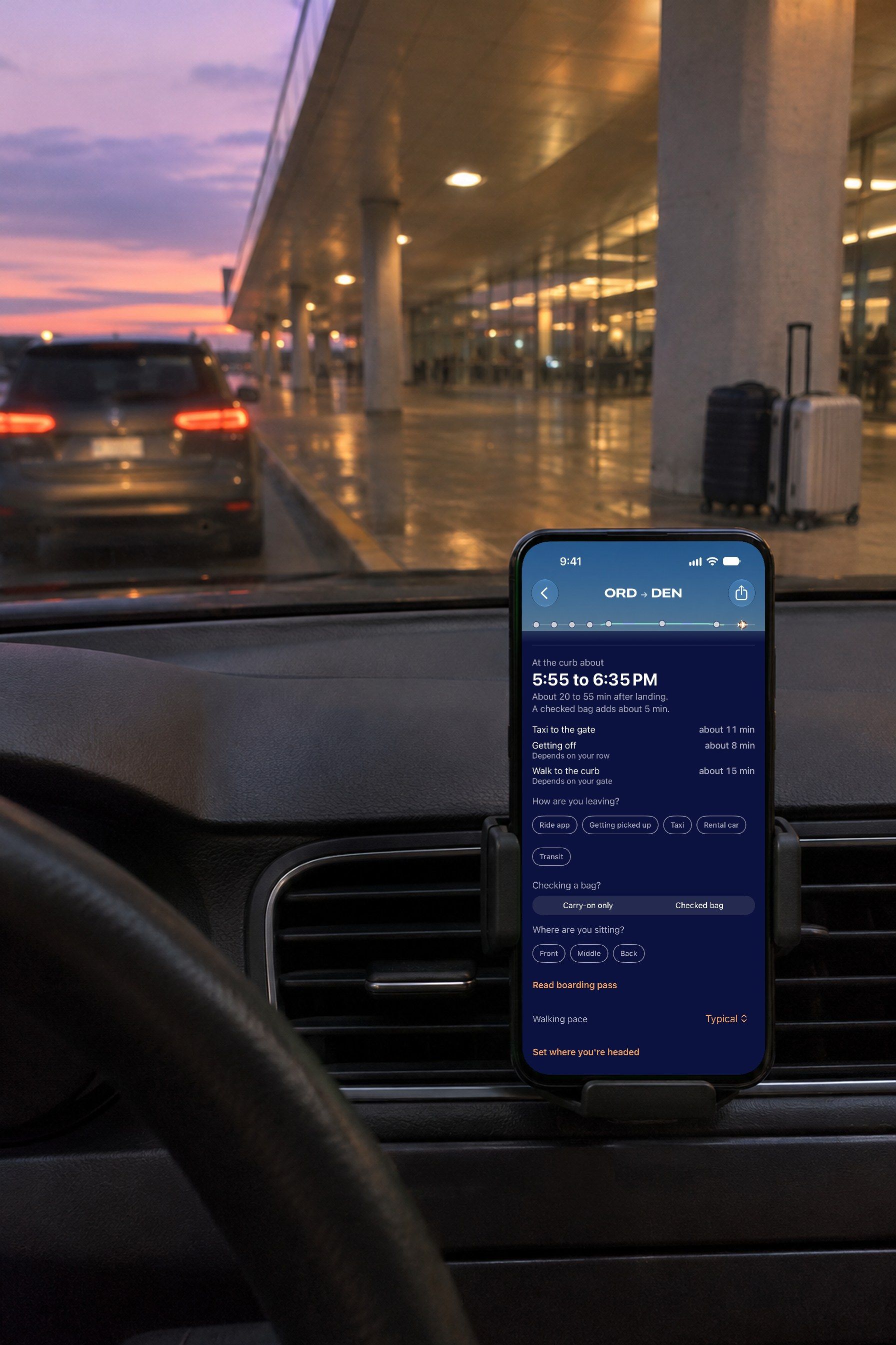
A phone in a dashboard cradle in a parked car at an airport’s arrivals curb at dusk, suitcases by a pillar ahead. On its screen, the Flight page after landing: At the curb about 5:55 to 6:35 PM, each part counted.

Landed

Know when you’ll be at the curb.

Landing time plus the taxi in, getting off and the walk out, so your ride arrives when you do.

At the curb about 5:55 to 6:35 PM. About 20 to 55 min after landing. A checked bag adds about 5 min. Taxi to the gate about 11 min, getting off about 8 min, walk to the curb about 15 min.

Everything else you need from a flight tracker.

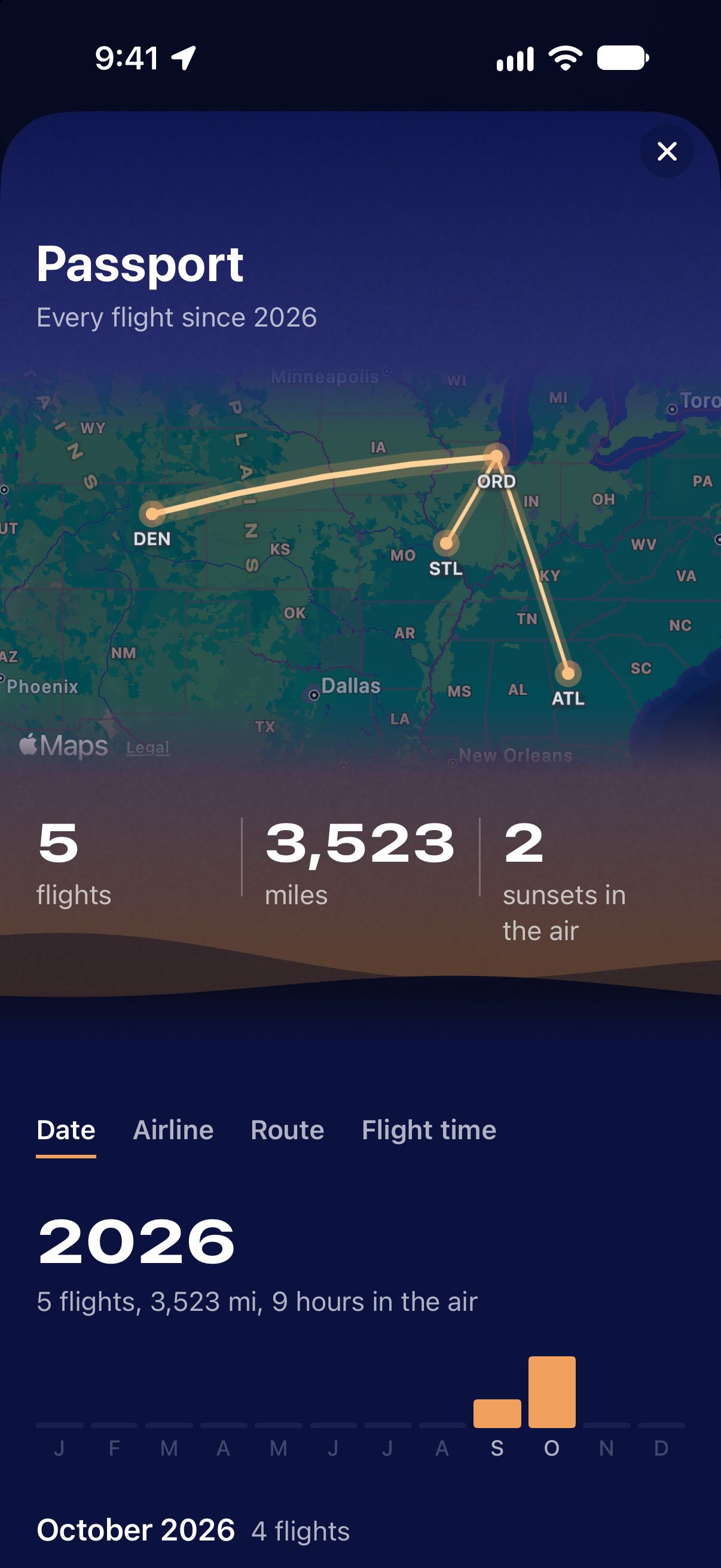
Your trips on a map, connections timed for you, a log of every flight, and a Mac app.
Designed for iPhone Duo, closed or open.

Every screen is laid out for the Duo: open, upright, closed, or standing on a tray table.
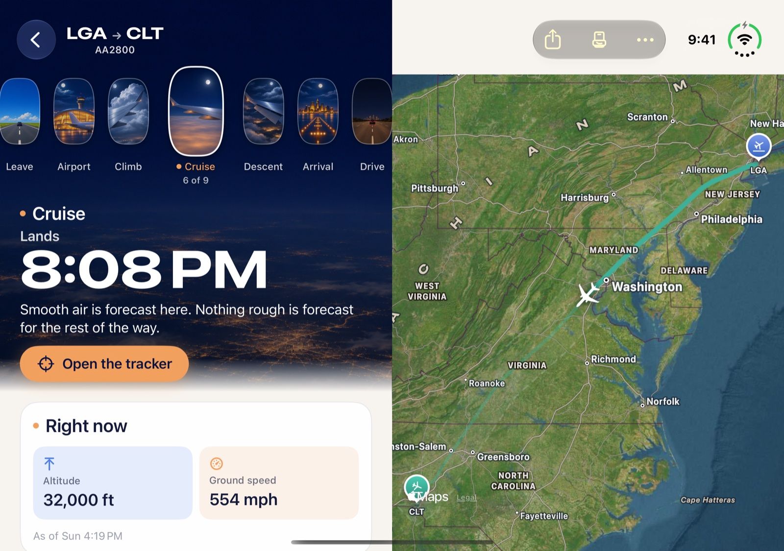
iPhone Duo open: the Flight page at cruise on the left page, Lands 8:08 PM, smooth air forecast; the live map of the route from LaGuardia to Charlotte on the right page.
Open Your flight on one page, the live map on the other.
iPhone Duo open and held upright: O’Hare in 3D at night across the inner screen, 20 airline flights on the ground, UA2458, DL2204 and AA75 labelled at the terminals.
Open, upright An airport in 3D across the whole inner screen.
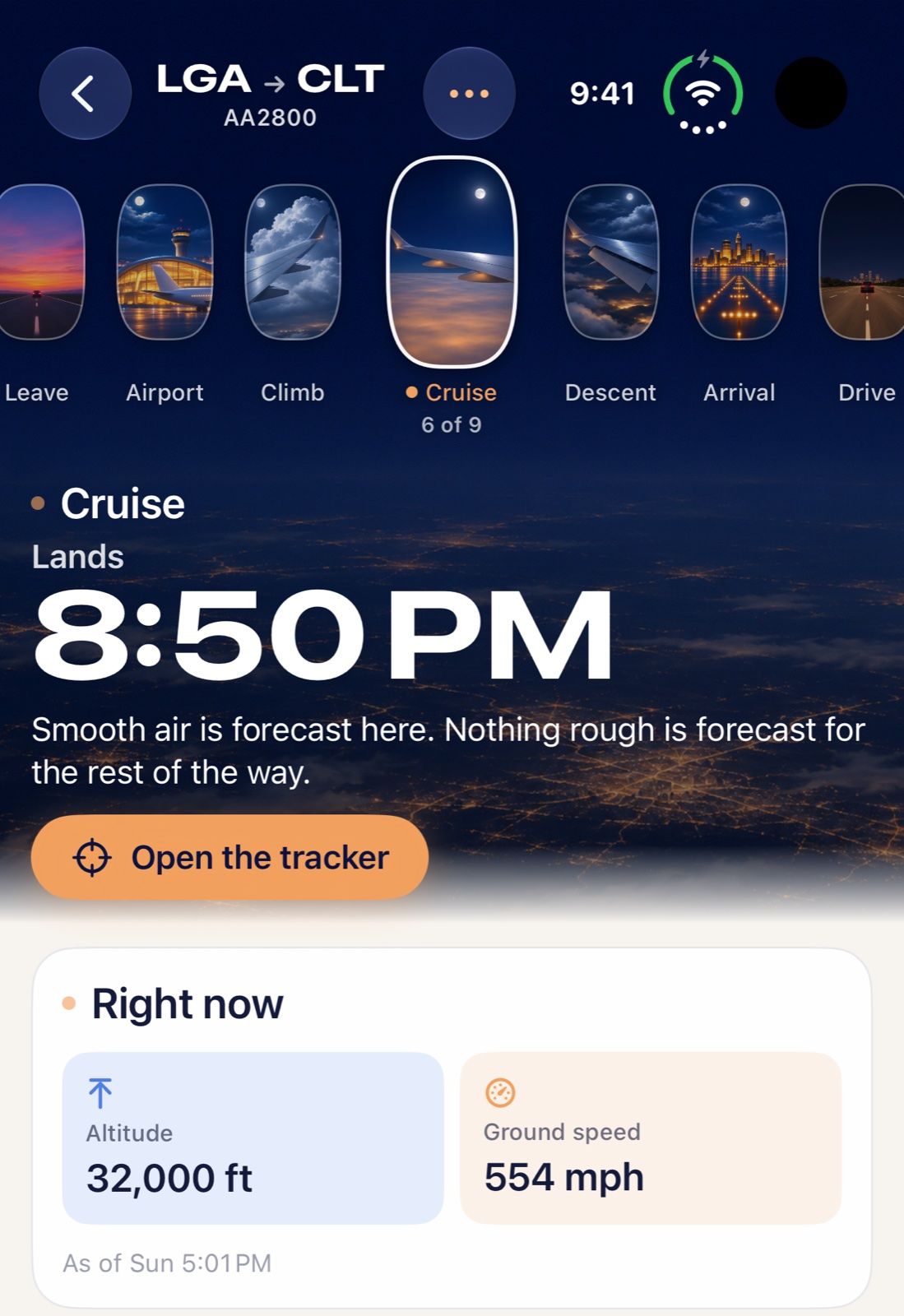
iPhone Duo closed: the Flight page at cruise on the outer screen, Lands 8:50 PM, smooth air forecast, altitude 32,000 ft, ground speed 554 mph.
Closed The whole Flight page on the outer screen.
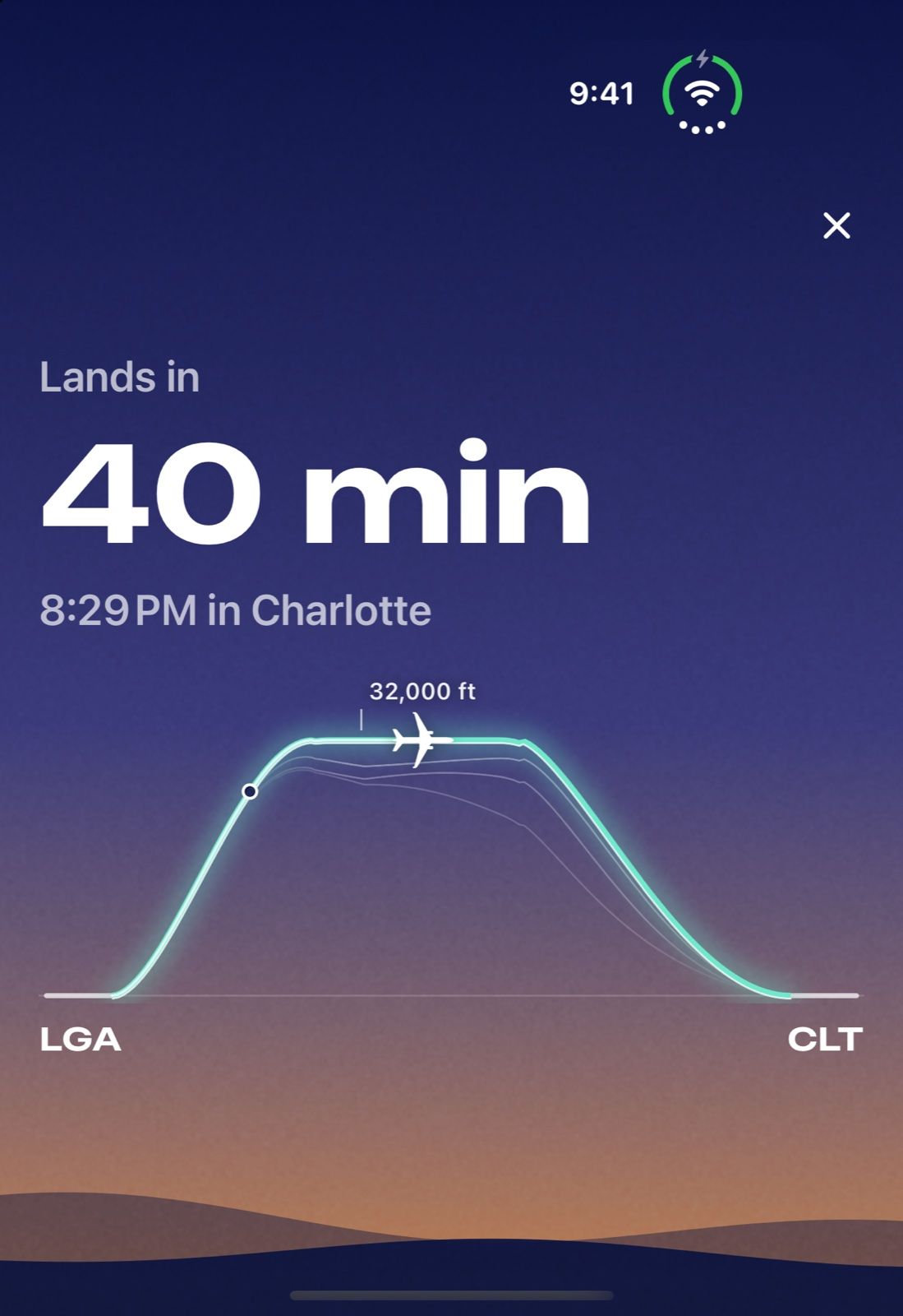
iPhone Duo standing in a tent on a tray table: Lands in 40 min, 8:29 PM in Charlotte, with the flight’s profile from LGA to CLT.
Standing up One number you can read from your seat.

Get Skycap for your next flight.

Add your flight tonight and get the ride forecast and your leave-by time before you fly.

Get Skycap on TestFlight

In beta for iPhone, iPad and Mac.